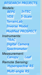
What is BEPS?
The Boreal Ecosystems Productivity Simulator
(BEPS) is a remote sensing approach to quantifying the
terrestrial carbon cycle. BEPS uses satellite data to map
the net carbon absorption rate by plants expressed as the
Net Primary Productivity (NPP). BEPS has recently
been expanded through the Integrated Terrestrial Ecosystem Carbon
model (InTEC). Expressed as the Net Ecosystem Productivity (NEP) which quantifies
the various carbon sinks and sources. The development of BEPS,
its validation and application, has
been the focus of a government-industry team of scientists
since 1994. Research on land cover and Leaf Area Index (LAI) mapping are supporting
activities to the development of BEPS. A radiative transfer
model named 4-Scale has been constructed to assist
in the LAI algorithm definitions and in radiation calculations
within BEPS. A ground-based optical instrument named TRAC has also been developed for quick and
accurate measurements of LAI.
This is a copy of the
same web page at the Canada Centre for Remote Sensing. Jing
M. Chen was a leader of a research team at CCRS who produced
these results.
Why do we do this research?
Terrestrial ecosystems are an important part of the climate
system. Their role in climate change, and in the global carbon
cycle is not well understood. Satellite remote sensing, coupled
with numerical models provide the unique tools for monitoring
the spatial and temporal dynamics of ecosystems and for quantifying
their role in climate change. Our work also results in the
highly synthesized information needed for sustainable management
of natural resources.
|