CARTOGRAPHIC MODEL (A.K.A. MAP ALGEBRA FLOW CHART)
- Should only represent GIS operations (including
data transfer between GIS's as a special case)
- Flowchart should permit user to duplicate all GIS
steps. You may want to do this now or keep a notebook of steps
performed
- Flowchart should use short map algebra terms. You
can make up you own term (e.g. "supervised classification").
- Ideally, the flowchart steps should fall within the
boxes in the conceptual data flow model that pertain to GIS/remote sensing
operations
- If the flowchart is too long or complicated break
it into separate flow charts for sub-tasks. e.g. Mapping liquor stores within 1
km of a mall and over 5 km from a church (this is really not complicated)
FLOWCHART 1:
Shows a buffer operation with input of malls and output of 1km buffers:
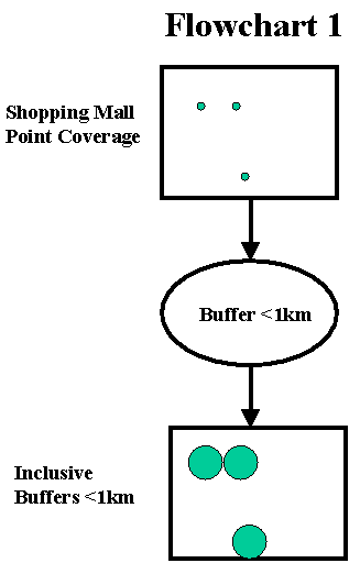
Identifying locations near stores. (1 Buffer operation only)
Buffer operation
- Required to identify regions close to shopping malls based on
problem statement criteria.
- GIS method - MapInfo Buffer command
- Parameters - 1 Buffer with distance set at 1km, buffer features
defined by point features locating stores.
- Output - Polygon coverage having a value of 1 within 1km of a
store point and 0 outside
FLOWCHART 2:
Shows a buffer operation with input of churches and output
of 5 km inclusive buffer; followed by a NOT command to make the buffer an
exclusive buffer:
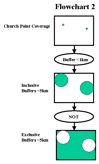
Identifying locations away from churches. (1 Buffer operation and 1 NOT
operation )
Buffer operation
- Required to identify regions within 5 km of churches.
- GIS method: MapInfo Buffer command
- Parameters: 1 Buffer with distance set
at < 5 km, buffer features defined by point features locating stores.
- Output: Polygon coverage having a value
of 1 < 5 km of a store point and 0 outside
NOT operation
- Required to identify regions >5km from a church.
-
GIS Method: MapInfo Select Command:
Output = NOT (Input)
-
Parameters: use NOT operator, input is
result from buffer operator above
-
Output: polygon coverage having a value
of 0 < 5 km of a store point and 1 outside
FLOWCHART 3:
Shows logical AND operator required to identify suitable liquor stores
using input of stores, and both buffers from flowchart 1 and 2.
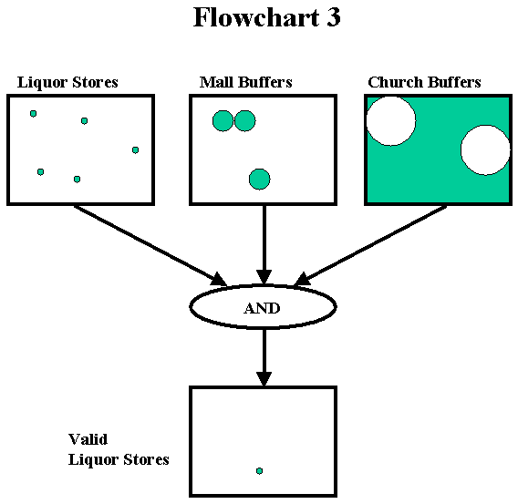
Identifying suitable liquor stores (really two MAP algebra operations)
AND (with three input layers)
- Required to identify regions away from churches and close to
stores based on problem statement criteria.
-
GIS method: MapInfo Select command
Output = Liquor store in (Buffer 1 and Buffer 2)
-
Parameters: Inputs: buffers from flow
charts 1 and 2 , point coverage of all liquor stores
-
Output: map of valid liquor stores
|
