LAI ANIMATION
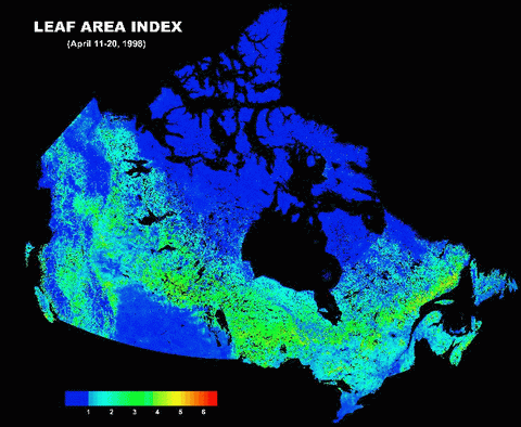
These leaf area index (LAI) maps
are created every 10 days during the growing season (1 April
to 30 November) using cloud-free 10-day composites of AVHRR.
The data pre-processing for compositing, cloud-screening,
atmospheric correction, BRDF correction, etc. were done at
the Canada Centre for Remote Sensing. LAI is defined as one
half the total leaf area per unit ground surface area. For
sloping surfaces, the ground area is projected to the nadir
view direction.
|